|
||
|
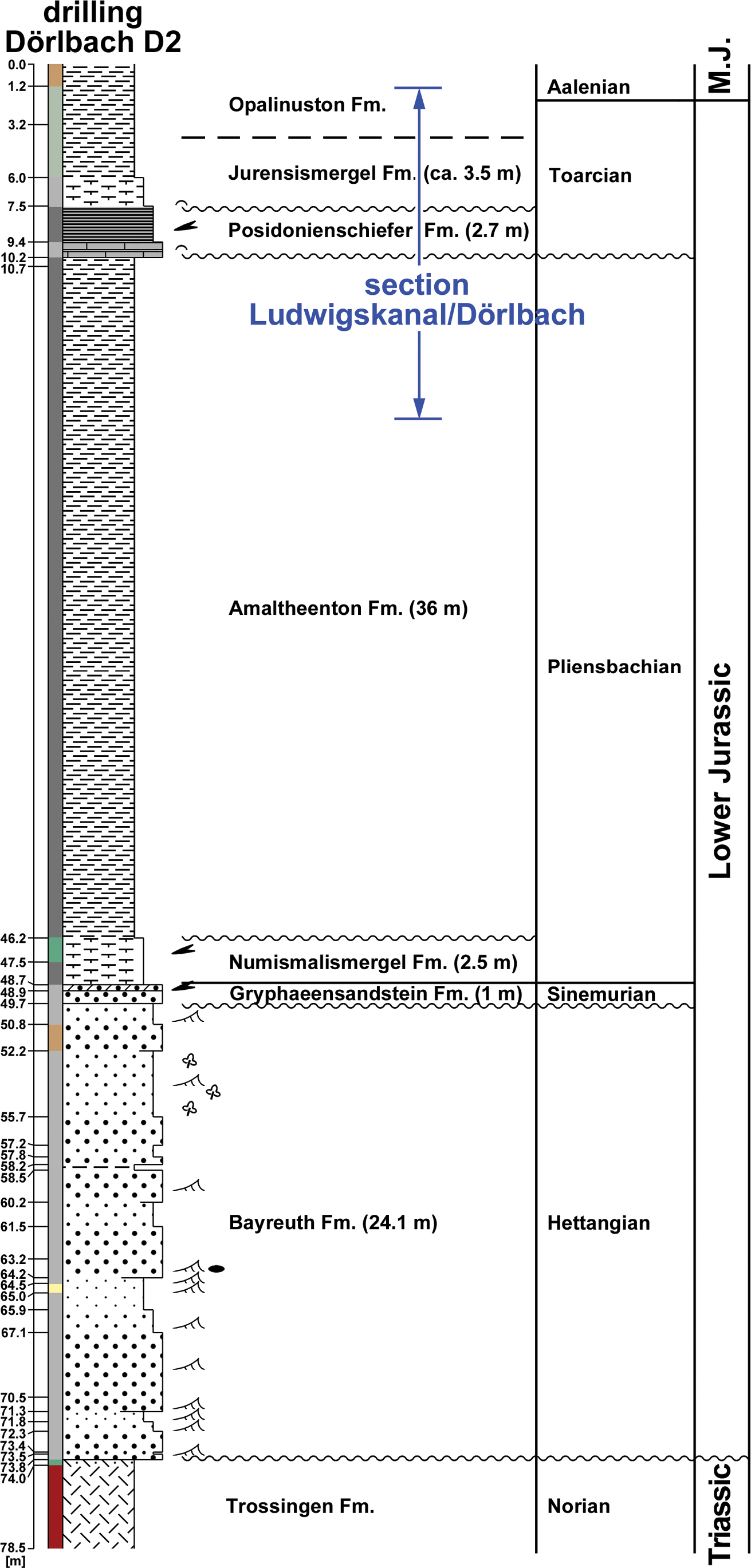
Overview of the Lower Jurassic Schwarzjura Group, Drilling Dörlbach D2 (top ground surface 436 m a.s.l., 49°21.679543N, 11°21.797843E; topographic map sheet 6634 Altdorf b. Nürnberg; unpublished drilling report), ca. 750 m N of the Ludwigskanal/Dörlbach section. For legend see Fig. 7. |